Title:
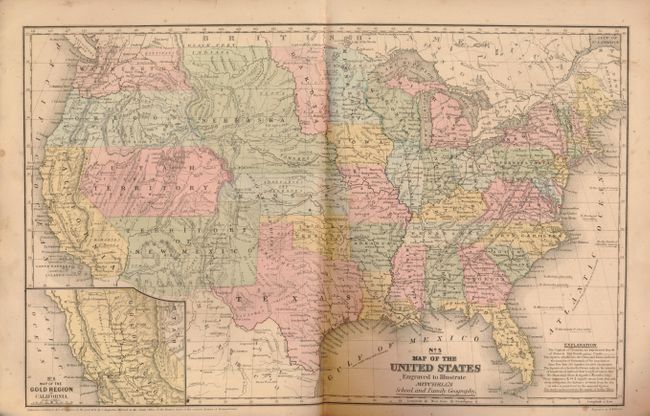
“Mitchell's School Atlas: Comprising the Maps and Tables Designed to Accompany Mitchell's School and Family Geography”
Map Maker:
Samuel Augustus Mitchell
This is a good example of Mitchell's famous school... (full text available to subscribers)
| Item Detail |
| |
| |
MapMaker: |
Samuel Augustus Mitchell
|
|
| |
| |
Subject: |
Atlases |
|
| |
Period/Size: |
1858 / 12.0" x 10.0" (30.5 x 25.4 cm)
|
|
| |
Color: |
Colored
|
|
| |
Condition: |
The maps vary good to very good mostly due to some foxing. The maps of Oceania and Asia have browning and damage to lower right blank tip with paper missing. Binding is mostly good but lower left corner is missing front and back with loss to list of oth (condition help) |
|
| |
Source: |
|
|
| |
References: |
|
|
| |
|
|
| Sales Information |
| |
| |
Price: |
|
|
| |
| |
Offered by: |
Old World Auctions |
|
| |
Catalog: |
Auction No. 133 - Antique Maps, Charts, Atlases & Globes (7404) |
|
| |
Lot/Item #: |
720 |
|
| |
| |
Date: |
09/2010
|
|
| |
| |
|
Antique Maps - Valuation and Pricing, Descriptions, Resources |
|
Home |
Information |
Search |
Register |
Contact Us |
Site Map
Americana Exchange, Inc. © 1999 - 2024 Americana Exchange, Inc.. All rights reserved.
OldMaps.com, the OldMaps.com logo and
AMPR are service marks or registered service marks of Americana Exchange, Inc..
|