| Item Detail |
| |
| |
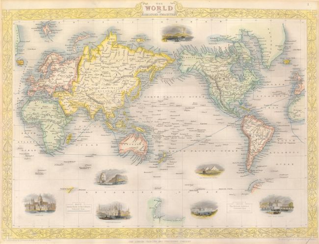
MapMaker: |
John Tallis
|
|
| |
| |
Subject: |
World |
|
| |
Period/Size: |
1851 / 10.3" x 13.8" (26.2 x 35.1 cm)
|
|
| |
Color: |
Colored
|
|
| |
Condition: |
Map is fine with strong impression and period-correct hand coloring. Margins are fully outside the border, always an issue with these maps. In upper blank margin is an old mat board burn, still fine. (condition help) |
|
| |
Source: |
The Illustrated Atlas… |
|
| |
References: |
|
|
| |
|
|
| Sales Information |
| |
| |
Price: |
|
|
| |
| |
Offered by: |
Old World Auctions |
|
| |
Catalog: |
Auction No. 134 - Antique Maps, Charts, Atlases & Globes (7405) |
|
| |
Lot/Item #: |
42 |
|
| |
| |
Date: |
12/2010
|
|
| |
| |
|