| Item Detail |
| |
| |
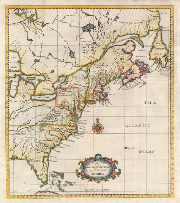
MapMaker: |
Thomas Salmon
|
|
| |
| |
Subject: |
Colonial Canada & United States |
|
| |
Period/Size: |
1760 / 13.5" x 11.8" (34.3 x 30.0 cm)
|
|
| |
Color: |
Colored
|
|
| |
Condition: |
Issued folded, now flattened with the binding trim replaced to accommodate framing. A clean 3" binding tear and a small tear between the tip of Florida and Cuba have been neatly repaired with tissue on verso. (condition help) |
|
| |
Source: |
A Brief Account of the War in North America |
|
| |
References: |
McCorkle #736.1. |
|
| |
|
|
| Sales Information |
| |
| |
Price: |
|
|
| |
| |
Offered by: |
Old World Auctions |
|
| |
Catalog: |
Auction No. 134 - Antique Maps, Charts, Atlases & Globes (7405) |
|
| |
Lot/Item #: |
131 |
|
| |
| |
Date: |
12/2010
|
|
| |
| |
|