Title:
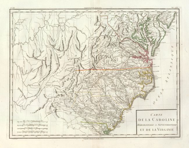
“Carte de la Caroline Meridionale et Septentrionale et de la Virginie”
Map Maker:
Pierre Francois Tardieu
The map shows all of North and South Carolina, Vir... (full text available to subscribers)
| Item Detail |
| |
| |
MapMaker: |
Pierre Francois Tardieu
|
|
| |
| |
Subject: |
Mid-Atlantic and Southeastern United States |
|
| |
Period/Size: |
1797 / 12.8" x 16.8" (32.6 x 42.7 cm)
|
|
| |
Color: |
Colored
|
|
| |
Condition: |
Fine, thick paper with very wide margins. Nice impression and color. A little centerfold toning. Grape cluster watermark. (condition help) |
|
| |
Source: |
Atlas Universel de Geographie Physique et Politique |
|
| |
References: |
|
|
| |
|
|
| Sales Information |
| |
| |
Price: |
|
|
| |
| |
Offered by: |
Old World Auctions |
|
| |
Catalog: |
Auction No. 134 - Antique Maps, Charts, Atlases & Globes (7405) |
|
| |
Lot/Item #: |
175 |
|
| |
| |
Date: |
12/2010
|
|
| |
| |
|
Antique Maps - Valuation and Pricing, Descriptions, Resources |
|
Home |
Information |
Search |
Register |
Contact Us |
Site Map
Americana Exchange, Inc. © 1999 - 2024 Americana Exchange, Inc.. All rights reserved.
OldMaps.com, the OldMaps.com logo and
AMPR are service marks or registered service marks of Americana Exchange, Inc..
|