Title:
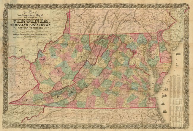
“Colton's New Topographical Map of the States of Virginia, Maryland and Delaware Showing also Eastern Tennessee & Parts of other Adjoining States, All of the Fortifications, Military Stations, Railroads, Common Road …”
Map Maker:
Joseph Hutchins Colton
Very large Civil War period pocket map that is han... (full text available to subscribers)
| Item Detail |
| |
| |
MapMaker: |
Joseph Hutchins Colton
|
|
| |
| |
Subject: |
Mid-Atlantic United States |
|
| |
Period/Size: |
1864 / 30.0" x 43.0" (76.2 x 109.3 cm)
|
|
| |
Color: |
Colored
|
|
| |
Condition: |
Presents well with fine original hand color, good impression and minimal flaws except for a number of fold intersection splits and splits on some folds. Would benefit from tissue backing. (condition help) |
|
| |
Source: |
|
|
| |
References: |
|
|
| |
|
|
| Sales Information |
| |
| |
Price: |
|
|
| |
| |
Offered by: |
Old World Auctions |
|
| |
Catalog: |
Auction No. 134 - Antique Maps, Charts, Atlases & Globes (7405) |
|
| |
Lot/Item #: |
177 |
|
| |
| |
Date: |
12/2010
|
|
| |
| |
|
Antique Maps - Valuation and Pricing, Descriptions, Resources |
|
Home |
Information |
Search |
Register |
Contact Us |
Site Map
Americana Exchange, Inc. © 1999 - 2024 Americana Exchange, Inc.. All rights reserved.
OldMaps.com, the OldMaps.com logo and
AMPR are service marks or registered service marks of Americana Exchange, Inc..
|