| Item Detail |
| |
| |
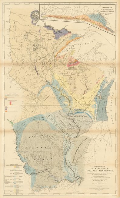
MapMaker: |
David Dale Owen
|
|
| |
| |
Subject: |
Midwestern United States, Wisconsin, Iowa, Minnesota |
|
| |
Period/Size: |
1851 / 43.8" x 26.0" (111.3 x 66.1 cm)
|
|
| |
Color: |
Colored
|
|
| |
Condition: |
This is a very nice example of this large folding map that features fine hand coloring, bright paper and dark impression. Just a trace of some fold toning, still very good for a map of this size. (condition help) |
|
| |
Source: |
|
|
| |
References: |
|
|
| |
|
|
| Sales Information |
| |
| |
Price: |
|
|
| |
| |
Offered by: |
Old World Auctions |
|
| |
Catalog: |
Auction No. 134 - Antique Maps, Charts, Atlases & Globes (7405) |
|
| |
Lot/Item #: |
199 |
|
| |
| |
Date: |
12/2010
|
|
| |
| |
|