| Item Detail |
| |
| |
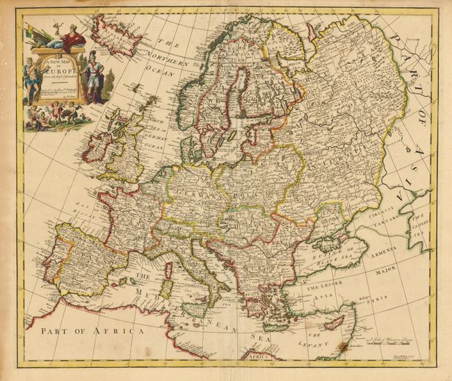
MapMaker: |
John Senex
|
|
| |
| |
Subject: |
Europe |
|
| |
Period/Size: |
1721 / 19.2" x 22.3" (48.8 x 56.7 cm)
|
|
| |
Color: |
Colored
|
|
| |
Condition: |
Nice impression and original color. There is some extraneous creasing at center and a fold separation entering the border at top. There is an old paper repair on the bottom fold and a stain on the Israel coastline. (condition help) |
|
| |
Source: |
New General Atlas |
|
| |
References: |
|
|
| |
|
|
| Sales Information |
| |
| |
Price: |
|
|
| |
| |
Offered by: |
Old World Auctions |
|
| |
Catalog: |
Auction No. 134 - Antique Maps, Charts, Atlases & Globes (7405) |
|
| |
Lot/Item #: |
396 |
|
| |
| |
Date: |
12/2010
|
|
| |
| |
|