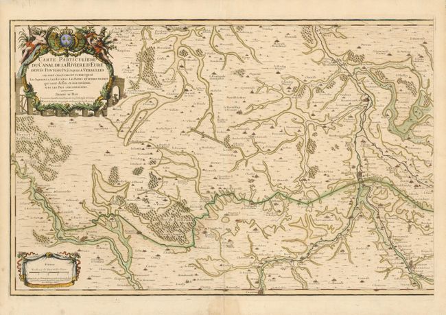
Title:
“Carte Particuliere du Canal de la Riviere d'Eure Depuis Pontgouin, jusques a Versailles ou sont exactement remarquez les Aqueducs, les Estangs, les Ponts, et autres Travaux...”
Map Maker:
Alexis-Hubert Jaillot
This scarce two sheet map shows in fantastic detai... (full text available to subscribers)
| Item Detail |
| |
| |
MapMaker: |
Alexis-Hubert Jaillot
|
|
| |
| |
Subject: |
Versailles, France |
|
| |
Period/Size: |
1690 / 18.3" x 56.0" (46.5 x 142.3 cm)
|
|
| |
Color: |
Colored
|
|
| |
Condition: |
Beautiful examples with strong impression and fine hand coloring. On very thick hand laid paper that has split along centerfold a few inches into maps from bottom. (condition help) |
|
| |
Source: |
|
|
| |
References: |
|
|
| |
|
|
| Sales Information |
| |
| |
Price: |
|
|
| |
| |
Offered by: |
Old World Auctions |
|
| |
Catalog: |
Auction No. 134 - Antique Maps, Charts, Atlases & Globes (7405) |
|
| |
Lot/Item #: |
474 |
|
| |
| |
Date: |
12/2010
|
|
| |
| |
|
Antique Maps - Valuation and Pricing, Descriptions, Resources |
|
Home |
Information |
Search |
Register |
Contact Us |
Site Map
Americana Exchange, Inc. © 1999 - 2024 Americana Exchange, Inc.. All rights reserved.
OldMaps.com, the OldMaps.com logo and
AMPR are service marks or registered service marks of Americana Exchange, Inc..
|