Title:
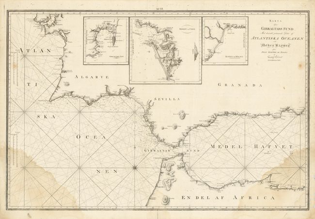
“Karta ofver Gibraltars Sund Med derintill gransande Delar af Atlantiska Oceanen och Medelhavet”
Map Maker:
Gustav af Klint
This large-scale sea chart is from a very scarce S... (full text available to subscribers)
| Item Detail |
| |
| |
MapMaker: |
Gustav af Klint
|
|
| |
| |
Subject: |
Strait of Gibraltar |
|
| |
Period/Size: |
1802 / 25.0" x 38.0" (63.5 x 96.6 cm)
|
|
| |
Color: |
Black & White
|
|
| |
Condition: |
Damp stains in lower corners and a few other spots in the map. There is a fold separation in the bottom blank margin. (condition help) |
|
| |
Source: |
|
|
| |
References: |
|
|
| |
|
|
| Sales Information |
| |
| |
Price: |
|
|
| |
| |
Offered by: |
Old World Auctions |
|
| |
Catalog: |
Auction No. 134 - Antique Maps, Charts, Atlases & Globes (7405) |
|
| |
Lot/Item #: |
578 |
|
| |
| |
Date: |
12/2010
|
|
| |
| |
|
Antique Maps - Valuation and Pricing, Descriptions, Resources |
|
Home |
Information |
Search |
Register |
Contact Us |
Site Map
Americana Exchange, Inc. © 1999 - 2024 Americana Exchange, Inc.. All rights reserved.
OldMaps.com, the OldMaps.com logo and
AMPR are service marks or registered service marks of Americana Exchange, Inc..
|