Title:
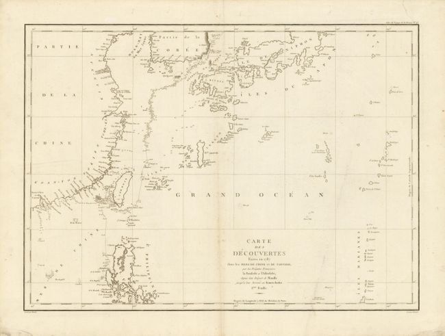
“Carte des Decouvertes Faites en 1787 dans les Mers de Chine et de Tartarie, par les Fregates Francaises la Boussole et l'Astrolabe depuis leur Depart de Manille jusqu'a leur Arrivee au Kamtschatka. 1ere Feuille”
Map Maker:
Jean Francois Galaup de La Perouse
This is La Perouse's general chart of discovery fo... (full text available to subscribers)
| Item Detail |
| |
| |
MapMaker: |
Jean Francois Galaup de La Perouse
|
|
| |
| |
Subject: |
Eastern Asia |
|
| |
Period/Size: |
1797 / 19.5" x 26.8" (49.6 x 68.1 cm)
|
|
| |
Color: |
Black & White
|
|
| |
Condition: |
On very thick hand laid paper with wide margins and two text-based watermarks. A little light toning or foxing along centerfold and a crease at right. (condition help) |
|
| |
Source: |
Voyage de la Perouse autour du monde… |
|
| |
References: |
|
|
| |
|
|
| Sales Information |
| |
| |
Price: |
|
|
| |
| |
Offered by: |
Old World Auctions |
|
| |
Catalog: |
Auction No. 134 - Antique Maps, Charts, Atlases & Globes (7405) |
|
| |
Lot/Item #: |
636 |
|
| |
| |
Date: |
12/2010
|
|
| |
| |
|
Antique Maps - Valuation and Pricing, Descriptions, Resources |
|
Home |
Information |
Search |
Register |
Contact Us |
Site Map
Americana Exchange, Inc. © 1999 - 2024 Americana Exchange, Inc.. All rights reserved.
OldMaps.com, the OldMaps.com logo and
AMPR are service marks or registered service marks of Americana Exchange, Inc..
|