| Item Detail |
| |
| |
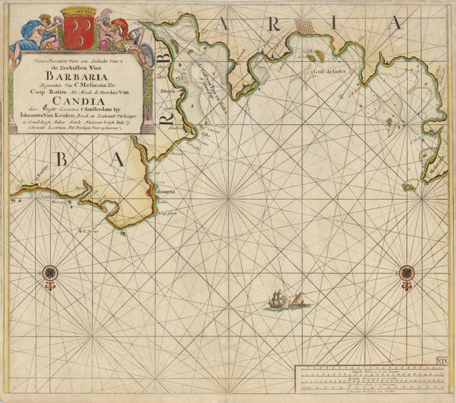
MapMaker: |
Johannes van Keulen
|
|
| |
| |
Subject: |
Northern Africa, Libya |
|
| |
Period/Size: |
1680 / 20.0" x 23.0" (50.8 x 58.5 cm)
|
|
| |
Color: |
Colored
|
|
| |
Condition: |
Backed with tissue to strengthen an area of damp stain and minor tears at top center. The right margin varies from 1/4" to none, as issued. (condition help) |
|
| |
Source: |
De Nieuwe Groote Lichtende Zee-Fackel |
|
| |
References: |
|
|
| |
|
|
| Sales Information |
| |
| |
Price: |
|
|
| |
| |
Offered by: |
Old World Auctions |
|
| |
Catalog: |
Auction No. 134 - Antique Maps, Charts, Atlases & Globes (7405) |
|
| |
Lot/Item #: |
687 |
|
| |
| |
Date: |
12/2010
|
|
| |
| |
|