Title:
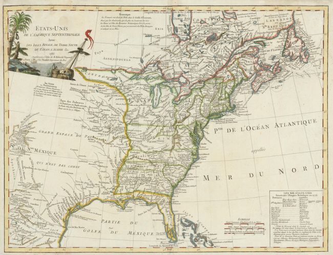
“Etats-Unis de l'Amerique Septentrionale avec les Isles Royale, de Terre Neuve, de St. Jean, l'Acadie &c.”
Map Maker:
Robert de Vaugondy/Boudet
This handsome map covers the newly created United ... (full text available to subscribers)
| Item Detail |
| |
| |
MapMaker: |
Robert de Vaugondy/Boudet
|
|
| |
| |
Subject: |
United States and Canada |
|
| |
Period/Size: |
1785 / 18.6" x 24.5" (47.3 x 62.3 cm)
|
|
| |
Color: |
Colored
|
|
| |
Condition: |
There has been some moisture damage in the map corners and centerfold resulting in some tears and paper weakness. All have been repaired and are now unobtrusive. (condition help) |
|
| |
Source: |
Atlas Universel |
|
| |
References: |
Karpinski (MI) #CIII; McCorkle #785.5; Pedley p. 227; Seller & Van Ee 761. |
|
| |
|
|
| Sales Information |
| |
| |
Price: |
|
|
| |
| |
Offered by: |
Old World Auctions |
|
| |
Catalog: |
Auction No. 135 - Antique Maps, Charts, Atlases & Globes (7406) |
|
| |
Lot/Item #: |
133 |
|
| |
| |
Date: |
02/2011
|
|
| |
| |
|
Antique Maps - Valuation and Pricing, Descriptions, Resources |
|
Home |
Information |
Search |
Register |
Contact Us |
Site Map
Americana Exchange, Inc. © 1999 - 2024 Americana Exchange, Inc.. All rights reserved.
OldMaps.com, the OldMaps.com logo and
AMPR are service marks or registered service marks of Americana Exchange, Inc..
|