Title:
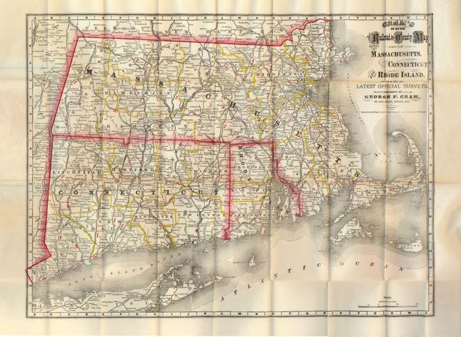
“Cram's New Railroad and County Map of Massachusetts, Connecticut and Rhode Island, from the Latest Official Surveys”
Map Maker:
George F. Cram [& Co.]
This is an early and colorful pocket map by the Ge... (full text available to subscribers)
| Item Detail |
| |
| |
MapMaker: |
George F. Cram [& Co.]
|
|
| |
| |
Subject: |
New England |
|
| |
Period/Size: |
1879 / 15.3" x 20.5" (38.9 x 52.1 cm)
|
|
| |
Color: |
Colored
|
|
| |
Condition: |
The map is a beautiful near flawless example. The covers are also very good with just slight wear. The rear end paper is cracking along spine. (condition help) |
|
| |
Source: |
|
|
| |
References: |
|
|
| |
|
|
| Sales Information |
| |
| |
Price: |
|
|
| |
| |
Offered by: |
Old World Auctions |
|
| |
Catalog: |
Auction No. 135 - Antique Maps, Charts, Atlases & Globes (7406) |
|
| |
Lot/Item #: |
172 |
|
| |
| |
Date: |
02/2011
|
|
| |
| |
|
Antique Maps - Valuation and Pricing, Descriptions, Resources |
|
Home |
Information |
Search |
Register |
Contact Us |
Site Map
Americana Exchange, Inc. © 1999 - 2024 Americana Exchange, Inc.. All rights reserved.
OldMaps.com, the OldMaps.com logo and
AMPR are service marks or registered service marks of Americana Exchange, Inc..
|