| Item Detail |
| |
| |
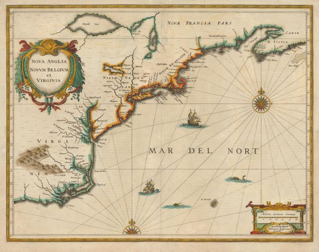
MapMaker: |
Jan Jansson
|
|
| |
| |
Subject: |
Colonial New England and Mid-Atlantic |
|
| |
Period/Size: |
1636 / 15.2" x 19.6" (38.6 x 49.8 cm)
|
|
| |
Color: |
Colored
|
|
| |
Condition: |
Early impression and old color. A portion of the verdigris along the coastline of Virginia and around the bottom of Grand Lac has been reinforced on verso with and old paper repair. There is also old paper reinforcing the centerfold and some other areas (condition help) |
|
| |
Source: |
Atlas |
|
| |
References: |
Burden #247; Cumming (SE) #39; Karpinski, p. 26 & 31 plt. II; McCorkle #636.2. |
|
| |
|
|
| Sales Information |
| |
| |
Price: |
|
|
| |
| |
Offered by: |
Old World Auctions |
|
| |
Catalog: |
Auction No. 135 - Antique Maps, Charts, Atlases & Globes (7406) |
|
| |
Lot/Item #: |
173 |
|
| |
| |
Date: |
02/2011
|
|
| |
| |
|