| Item Detail |
| |
| |
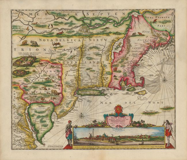
MapMaker: |
Justus Danckerts
|
|
| |
| |
Subject: |
Colonial New England and Mid Atlantic |
|
| |
Period/Size: |
1690 / 18.0" x 21.3" (45.8 x 54.1 cm)
|
|
| |
Color: |
Colored
|
|
| |
Condition: |
There is some minor soil and creasing along the centerfold. The map has been completely remargined seamlessly using the leaf-casting method and period paper, with some loss of image at top replaced in very skillful facsimile. Some minor paper weaknesses (condition help) |
|
| |
Source: |
|
|
| |
References: |
Burden #434; McCorkle #680.2; Tooley (Amer), p. 286, Campbell, Jansson-Visscher #9a. |
|
| |
|
|
| Sales Information |
| |
| |
Price: |
|
|
| |
| |
Offered by: |
Old World Auctions |
|
| |
Catalog: |
Auction No. 135 - Antique Maps, Charts, Atlases & Globes (7406) |
|
| |
Lot/Item #: |
174 |
|
| |
| |
Date: |
02/2011
|
|
| |
| |
|