Title:
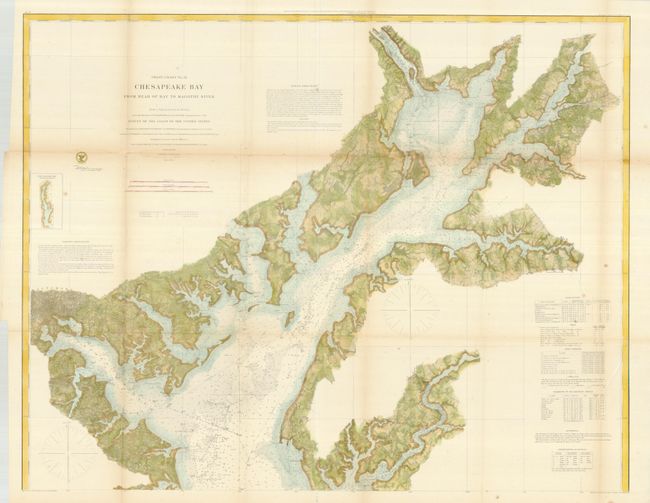
“Coast Chart No. 31- Chesapeake Bay From Head of Bay to Magothy River”
Map Maker:
U.S. Coast Survey
This a very detailed chart showing the northern re... (full text available to subscribers)
| Item Detail |
| |
| |
MapMaker: |
U.S. Coast Survey
|
|
| |
| |
Subject: |
Mid-Atlantic |
|
| |
Period/Size: |
1861 / 29.5" x 37.5" (75.0 x 95.3 cm)
|
|
| |
Color: |
Colored
|
|
| |
Condition: |
Minimal fold toning with a few fold separations, some closed with archival tape on verso. (condition help) |
|
| |
Source: |
|
|
| |
References: |
|
|
| |
|
|
| Sales Information |
| |
| |
Price: |
|
|
| |
| |
Offered by: |
Old World Auctions |
|
| |
Catalog: |
Auction No. 135 - Antique Maps, Charts, Atlases & Globes (7406) |
|
| |
Lot/Item #: |
182 |
|
| |
| |
Date: |
02/2011
|
|
| |
| |
|
Antique Maps - Valuation and Pricing, Descriptions, Resources |
|
Home |
Information |
Search |
Register |
Contact Us |
Site Map
Americana Exchange, Inc. © 1999 - 2024 Americana Exchange, Inc.. All rights reserved.
OldMaps.com, the OldMaps.com logo and
AMPR are service marks or registered service marks of Americana Exchange, Inc..
|