Title:
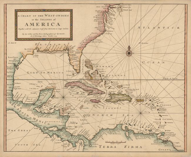
“A Chart of the West-Indies or the Islands of America Together with the Adjacent Coast from Suriname to Cape Cod &c.”
Map Maker:
Seller & Price
This is an extremely rare English chart of ... (full text available to subscribers)
| Item Detail |
| |
| |
MapMaker: |
Seller & Price
|
|
| |
| |
Subject: |
Gulf of Mexico and Caribbean |
|
| |
Period/Size: |
1703 / 18.6" x 23.2" (47.3 x 59.0 cm)
|
|
| |
Color: |
Colored
|
|
| |
Condition: |
Nice impression with some minor tissue repairs on paper edges, not affecting the map. (condition help) |
|
| |
Source: |
|
|
| |
References: |
|
|
| |
|
|
| Sales Information |
| |
| |
Price: |
|
|
| |
| |
Offered by: |
Old World Auctions |
|
| |
Catalog: |
Auction No. 135 - Antique Maps, Charts, Atlases & Globes (7406) |
|
| |
Lot/Item #: |
349 |
|
| |
| |
Date: |
02/2011
|
|
| |
| |
|
Antique Maps - Valuation and Pricing, Descriptions, Resources |
|
Home |
Information |
Search |
Register |
Contact Us |
Site Map
Americana Exchange, Inc. © 1999 - 2024 Americana Exchange, Inc.. All rights reserved.
OldMaps.com, the OldMaps.com logo and
AMPR are service marks or registered service marks of Americana Exchange, Inc..
|