Title:
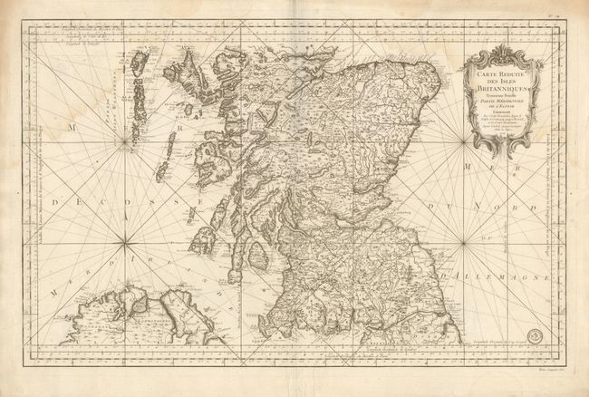
“Carte Reduite des Isles Britanniques Troisieme Feuille Partie Meridionale de l'Ecosse”
Map Maker:
Jacques Nicolas Bellin
This superb, large-scale chart details southern Sc... (full text available to subscribers)
| Item Detail |
| |
| |
MapMaker: |
Jacques Nicolas Bellin
|
|
| |
| |
Subject: |
Scotland |
|
| |
Period/Size: |
1757 / 21.8" x 34.0" (55.4 x 86.4 cm)
|
|
| |
Color: |
Black & White
|
|
| |
Condition: |
Beautiful, dark impression on thick paper with full margins. Light water stain along upper border and entering upper corners of map. (condition help) |
|
| |
Source: |
Hydrographie Francoise |
|
| |
References: |
|
|
| |
|
|
| Sales Information |
| |
| |
Price: |
|
|
| |
| |
Offered by: |
Old World Auctions |
|
| |
Catalog: |
Auction No. 135 - Antique Maps, Charts, Atlases & Globes (7406) |
|
| |
Lot/Item #: |
456 |
|
| |
| |
Date: |
02/2011
|
|
| |
| |
|
Antique Maps - Valuation and Pricing, Descriptions, Resources |
|
Home |
Information |
Search |
Register |
Contact Us |
Site Map
Americana Exchange, Inc. © 1999 - 2024 Americana Exchange, Inc.. All rights reserved.
OldMaps.com, the OldMaps.com logo and
AMPR are service marks or registered service marks of Americana Exchange, Inc..
|