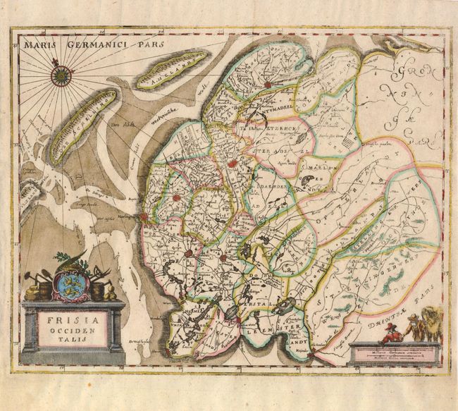
Title:
“Frisia Occidentalis”
Map Maker:
Matthaus Merian
Based on Blaeu's map of the province of Friesland,... (full text available to subscribers)
| Item Detail |
| |
| |
MapMaker: |
Matthaus Merian
|
|
| |
| |
Subject: |
Netherlands |
|
| |
Period/Size: |
1660 / 10.3" x 13.0" (26.2 x 33.1 cm)
|
|
| |
Color: |
Colored
|
|
| |
Condition: |
The impression is a bit uneven and the map is printed on thin paper, as was common with German maps of this period. (condition help) |
|
| |
Source: |
|
|
| |
References: |
|
|
| |
|
|
| Sales Information |
| |
| |
Price: |
|
|
| |
| |
Offered by: |
Old World Auctions |
|
| |
Catalog: |
Auction No. 135 - Antique Maps, Charts, Atlases & Globes (7406) |
|
| |
Lot/Item #: |
473 |
|
| |
| |
Date: |
02/2011
|
|
| |
| |
|
Antique Maps - Valuation and Pricing, Descriptions, Resources |
|
Home |
Information |
Search |
Register |
Contact Us |
Site Map
Americana Exchange, Inc. © 1999 - 2024 Americana Exchange, Inc.. All rights reserved.
OldMaps.com, the OldMaps.com logo and
AMPR are service marks or registered service marks of Americana Exchange, Inc..
|