Title:
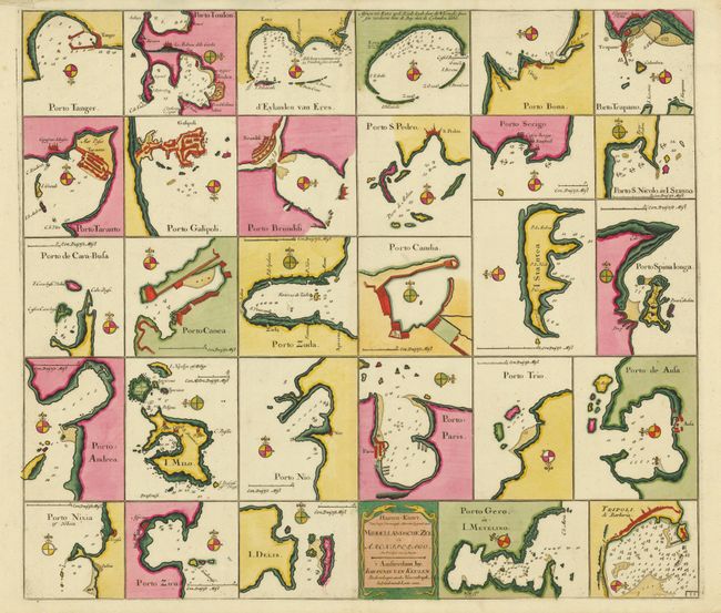
“Haaven-Kaart van Eenige Voornaamste Haavens Leggende in de Middel-Landsche Zee en Archipelago”
Map Maker:
Johannes van Keulen
The is a superb chart illustrating 29 ports in the... (full text available to subscribers)
| Item Detail |
| |
| |
MapMaker: |
Johannes van Keulen
|
|
| |
| |
Subject: |
Mediterranean |
|
| |
Period/Size: |
1700 / 20.0" x 23.0" (50.8 x 58.5 cm)
|
|
| |
Color: |
Colored
|
|
| |
Condition: |
A fine example with original color with the fleur-de-lis on the compass rose all highlighted in gold leaf. There are a couple tears in the top margin. (condition help) |
|
| |
Source: |
De Nieuwe Groote Lichtende Zee-Fakkel |
|
| |
References: |
|
|
| |
|
|
| Sales Information |
| |
| |
Price: |
|
|
| |
| |
Offered by: |
Old World Auctions |
|
| |
Catalog: |
Auction No. 135 - Antique Maps, Charts, Atlases & Globes (7406) |
|
| |
Lot/Item #: |
567 |
|
| |
| |
Date: |
02/2011
|
|
| |
| |
|
Antique Maps - Valuation and Pricing, Descriptions, Resources |
|
Home |
Information |
Search |
Register |
Contact Us |
Site Map
Americana Exchange, Inc. © 1999 - 2024 Americana Exchange, Inc.. All rights reserved.
OldMaps.com, the OldMaps.com logo and
AMPR are service marks or registered service marks of Americana Exchange, Inc..
|