Title:
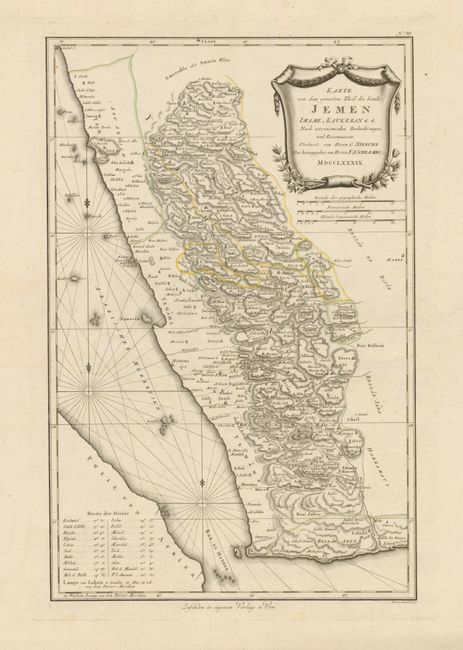
“Karte von dem Groessten Theil des Landes Jemen Imame, Kaukeban &c.”
Map Maker:
Franz Anton Schrambl
This is a scarce, detailed and finely engraved map... (full text available to subscribers)
| Item Detail |
| |
| |
MapMaker: |
Franz Anton Schrambl
|
|
| |
| |
Subject: |
Arabia, Yemen |
|
| |
Period/Size: |
1789 / 22.4" x 14.5" (56.9 x 36.9 cm)
|
|
| |
Color: |
Colored
|
|
| |
Condition: |
The map image is fine, but there is a little toning or soiling along bottom edge on very wide (5") margin. On thick paper with enormous margins this map has never been folded. (condition help) |
|
| |
Source: |
|
|
| |
References: |
|
|
| |
|
|
| Sales Information |
| |
| |
Price: |
|
|
| |
| |
Offered by: |
Old World Auctions |
|
| |
Catalog: |
Auction No. 135 - Antique Maps, Charts, Atlases & Globes (7406) |
|
| |
Lot/Item #: |
608 |
|
| |
| |
Date: |
02/2011
|
|
| |
| |
|
Antique Maps - Valuation and Pricing, Descriptions, Resources |
|
Home |
Information |
Search |
Register |
Contact Us |
Site Map
Americana Exchange, Inc. © 1999 - 2024 Americana Exchange, Inc.. All rights reserved.
OldMaps.com, the OldMaps.com logo and
AMPR are service marks or registered service marks of Americana Exchange, Inc..
|