Title:
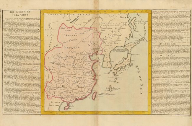
“De l'Empire de la Chine”
Map Maker:
Jean Baptiste Louis Clouet
This map shows China, Japan, Korea (Coree), and Fo... (full text available to subscribers)
| Item Detail |
| |
| |
MapMaker: |
Jean Baptiste Louis Clouet
|
|
| |
| |
Subject: |
China, Korea & Japan |
|
| |
Period/Size: |
1767 / 12.2" x 12.8" (31.0 x 32.6 cm)
|
|
| |
Color: |
Colored
|
|
| |
Condition: |
Fine impression and coloring on a full sheet of thick hand laid paper with original margins. Two large watermarks. The centerfold has some damp staining with associated color runs. (condition help) |
|
| |
Source: |
Geographie Moderne |
|
| |
References: |
|
|
| |
|
|
| Sales Information |
| |
| |
Price: |
|
|
| |
| |
Offered by: |
Old World Auctions |
|
| |
Catalog: |
Auction No. 135 - Antique Maps, Charts, Atlases & Globes (7406) |
|
| |
Lot/Item #: |
642 |
|
| |
| |
Date: |
02/2011
|
|
| |
| |
|
Antique Maps - Valuation and Pricing, Descriptions, Resources |
|
Home |
Information |
Search |
Register |
Contact Us |
Site Map
Americana Exchange, Inc. © 1999 - 2024 Americana Exchange, Inc.. All rights reserved.
OldMaps.com, the OldMaps.com logo and
AMPR are service marks or registered service marks of Americana Exchange, Inc..
|