| Item Detail |
| |
| |
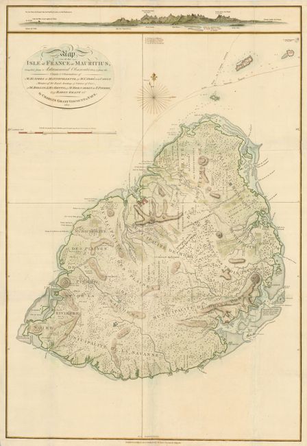
MapMaker: |
Charles Grant
|
|
| |
| |
Subject: |
Mauritius, Indian Ocean |
|
| |
Period/Size: |
1801 / 28.3" x 19.3" (71.9 x 49.1 cm)
|
|
| |
Color: |
Colored
|
|
| |
Condition: |
Printed on heavy paper, issued folding, now flattened with folds repaired and reinforced with tissue on verso. There is some unobtrusive tissue on blank areas of the face of the map. (condition help) |
|
| |
Source: |
History of Mauritius |
|
| |
References: |
|
|
| |
|
|
| Sales Information |
| |
| |
Price: |
|
|
| |
| |
Offered by: |
Old World Auctions |
|
| |
Catalog: |
Auction No. 135 - Antique Maps, Charts, Atlases & Globes (7406) |
|
| |
Lot/Item #: |
680 |
|
| |
| |
Date: |
02/2011
|
|
| |
| |
|