Title:
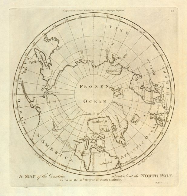
“A Map of the Countries Situate about the North Pole, as far as the 50th Degree of North Latitude”
Map Maker:
Mathew Carey
This is the first map of the North Pole published ... (full text available to subscribers)
| Item Detail |
| |
| |
MapMaker: |
Mathew Carey
|
|
| |
| |
Subject: |
North Pole |
|
| |
Period/Size: |
1799 / 9.4" x 9.4" (23.9 x 23.9 cm)
|
|
| |
Color: |
Black & White
|
|
| |
Condition: |
(condition help) |
|
| |
Source: |
General Atlas |
|
| |
References: |
Wheat & Brun #915. |
|
| |
|
|
| Sales Information |
| |
| |
Price: |
|
|
| |
| |
Offered by: |
Old World Auctions |
|
| |
Catalog: |
Auction No. 136 - Antique Maps, Charts, Atlases & Globes (7407) |
|
| |
Lot/Item #: |
52 |
|
| |
| |
Date: |
06/2011
|
|
| |
| |
|
Antique Maps - Valuation and Pricing, Descriptions, Resources |
|
Home |
Information |
Search |
Register |
Contact Us |
Site Map
Americana Exchange, Inc. © 1999 - 2024 Americana Exchange, Inc.. All rights reserved.
OldMaps.com, the OldMaps.com logo and
AMPR are service marks or registered service marks of Americana Exchange, Inc..
|