Title:
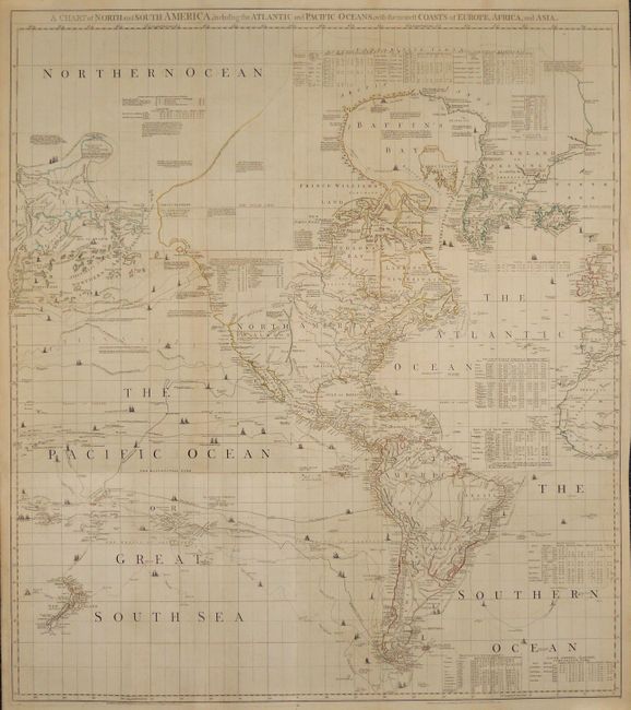
“A Chart of North and South America, Including the Atlantic and Pacific Oceans, with the Nearest Coasts of Europe, Africa, and Asia”
Map Maker:
Jefferys/Sayer & Bennett
This important American map was compiled in 1753 b... (full text available to subscribers)
| Item Detail |
| |
| |
MapMaker: |
Jefferys/Sayer & Bennett
|
|
| |
| |
Subject: |
Western Hemisphere - America |
|
| |
Period/Size: |
1775 / 50.5" x 43.5" (128.3 x 110.5 cm)
|
|
| |
Color: |
Colored
|
|
| |
Condition: |
A superb example with original outline color and some expert minor repairs in the blank margins. (condition help) |
|
| |
Source: |
The America Atlas |
|
| |
References: |
Ristow pp. 31-32; Stevens & Tree #4e; Wagner (NW) #578 & p. 160 (1st ed.). |
|
| |
|
|
| Sales Information |
| |
| |
Price: |
|
|
| |
| |
Offered by: |
Old World Auctions |
|
| |
Catalog: |
Auction No. 136 - Antique Maps, Charts, Atlases & Globes (7407) |
|
| |
Lot/Item #: |
80 |
|
| |
| |
Date: |
06/2011
|
|
| |
| |
|
Antique Maps - Valuation and Pricing, Descriptions, Resources |
|
Home |
Information |
Search |
Register |
Contact Us |
Site Map
Americana Exchange, Inc. © 1999 - 2024 Americana Exchange, Inc.. All rights reserved.
OldMaps.com, the OldMaps.com logo and
AMPR are service marks or registered service marks of Americana Exchange, Inc..
|