| Item Detail |
| |
| |
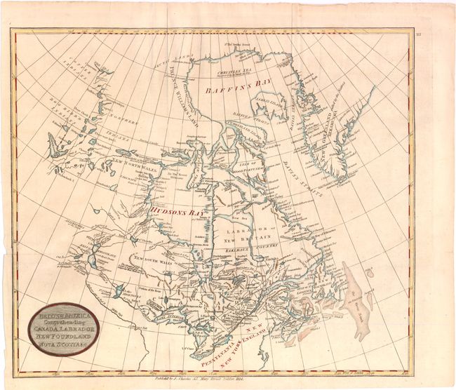
MapMaker: |
J. Charles
|
|
| |
| |
Subject: |
Canada |
|
| |
Period/Size: |
1814 / 13.0" x 15.0" (33.1 x 38.1 cm)
|
|
| |
Color: |
Colored
|
|
| |
Condition: |
Dark early impression, printed on watermarked paper, "W. Pickering & Co. 1814." Issued folding, now pressed. One fold split enters map 1" at bottom, well closed on verso with paper. (condition help) |
|
| |
Source: |
|
|
| |
References: |
|
|
| |
|
|
| Sales Information |
| |
| |
Price: |
|
|
| |
| |
Offered by: |
Old World Auctions |
|
| |
Catalog: |
Auction No. 136 - Antique Maps, Charts, Atlases & Globes (7407) |
|
| |
Lot/Item #: |
118 |
|
| |
| |
Date: |
06/2011
|
|
| |
| |
|