| Item Detail |
| |
| |
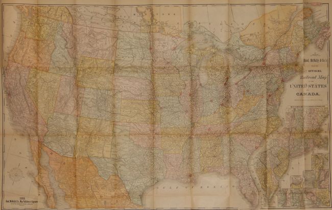
MapMaker: |
Rand, McNally & Co.
|
|
| |
| |
Subject: |
United States and Canada |
|
| |
Period/Size: |
1885 / 26.8" x 42.5" (68.1 x 108.0 cm)
|
|
| |
Color: |
Colored
|
|
| |
Condition: |
The map is fine except for a nearly invisible, small puncture in Indian Territory that is closed on the blank verso and clean tear in lower margin well away from map, closed on verso. The report and covers are also very good with only a small amount of w (condition help) |
|
| |
Source: |
|
|
| |
References: |
|
|
| |
|
|
| Sales Information |
| |
| |
Price: |
|
|
| |
| |
Offered by: |
Old World Auctions |
|
| |
Catalog: |
Auction No. 136 - Antique Maps, Charts, Atlases & Globes (7407) |
|
| |
Lot/Item #: |
140 |
|
| |
| |
Date: |
06/2011
|
|
| |
| |
|