Title:
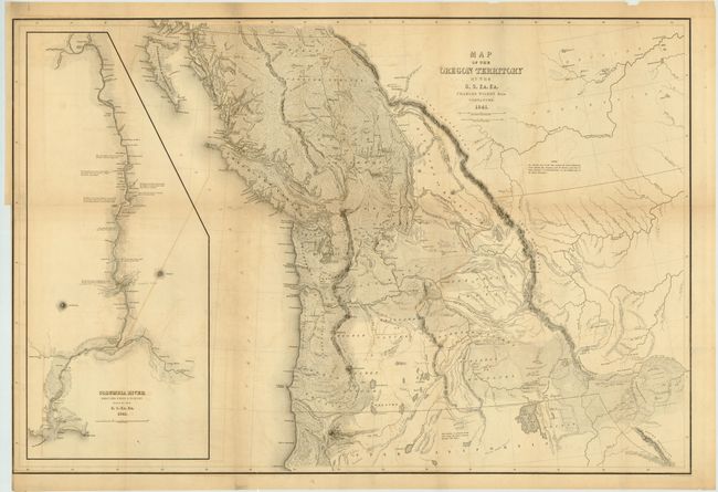
“Map of the Oregon Territory by the U.S. Ex. Ex.”
Map Maker:
Charles Wilkes
An important map that Wheat says is "really quite ... (full text available to subscribers)
| Item Detail |
| |
| |
MapMaker: |
Charles Wilkes
|
|
| |
| |
Subject: |
Western Canada & United States |
|
| |
Period/Size: |
1841 / 22.8" x 34.5" (58.0 x 87.7 cm)
|
|
| |
Color: |
Black & White
|
|
| |
Condition: |
The map and paper are remarkably sound for a large folding map. There is some minor toning and offsetting with a few fold intersections reinforced with archival tape on verso. (condition help) |
|
| |
Source: |
Narrative of the United States Exploring Expeditionģ |
|
| |
References: |
Wheat (TMW) 457 |
|
| |
|
|
| Sales Information |
| |
| |
Price: |
|
|
| |
| |
Offered by: |
Old World Auctions |
|
| |
Catalog: |
Auction No. 136 - Antique Maps, Charts, Atlases & Globes (7407) |
|
| |
Lot/Item #: |
144 |
|
| |
| |
Date: |
06/2011
|
|
| |
| |
|
Antique Maps - Valuation and Pricing, Descriptions, Resources |
|
Home |
Information |
Search |
Register |
Contact Us |
Site Map
Americana Exchange, Inc. © 1999 - 2024 Americana Exchange, Inc.. All rights reserved.
OldMaps.com, the OldMaps.com logo and
AMPR are service marks or registered service marks of Americana Exchange, Inc..
|