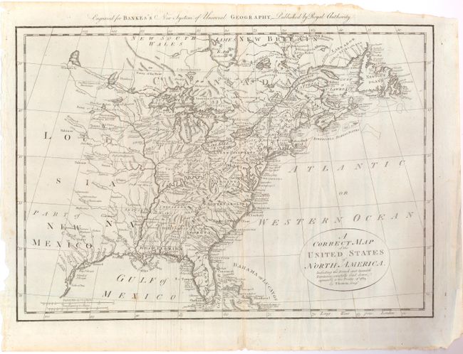
Title:
“A Correct Map of the United States of North America, Including the British and Spanish Territories, carefully laid down agreeable to the Treaty of 1784”
Map Maker:
Thomas Bowen
An early map of the United States created at the c... (full text available to subscribers)
| Item Detail |
| |
| |
MapMaker: |
Thomas Bowen
|
|
| |
| |
Subject: |
Eastern United States |
|
| |
Period/Size: |
1787 / 12.5" x 17.5" (31.8 x 44.5 cm)
|
|
| |
Color: |
Black & White
|
|
| |
Condition: |
Some light toning and creasing in the image. Blank margins have a few tears not affecting map. (condition help) |
|
| |
Source: |
Banke's New System of Universal Geography, Published by Royal Authority |
|
| |
References: |
McCorkle #787.1; Sellers & Van Ee #756. |
|
| |
|
|
| Sales Information |
| |
| |
Price: |
|
|
| |
| |
Offered by: |
Old World Auctions |
|
| |
Catalog: |
Auction No. 136 - Antique Maps, Charts, Atlases & Globes (7407) |
|
| |
Lot/Item #: |
167 |
|
| |
| |
Date: |
06/2011
|
|
| |
| |
|
Antique Maps - Valuation and Pricing, Descriptions, Resources |
|
Home |
Information |
Search |
Register |
Contact Us |
Site Map
Americana Exchange, Inc. © 1999 - 2024 Americana Exchange, Inc.. All rights reserved.
OldMaps.com, the OldMaps.com logo and
AMPR are service marks or registered service marks of Americana Exchange, Inc..
|