| Item Detail |
| |
| |
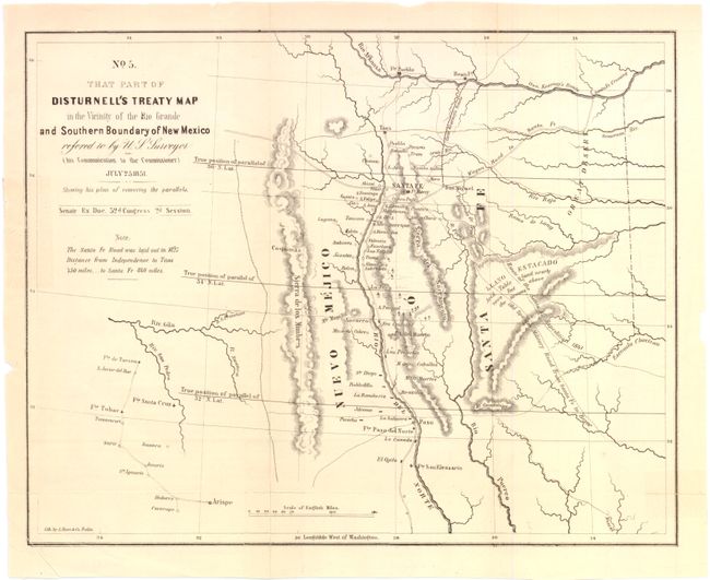
MapMaker: |
U.S. Government
|
|
| |
| |
Subject: |
United States - Southwestern |
|
| |
Period/Size: |
1851 / 8.8" x 10.8" (22.3 x 27.4 cm)
|
|
| |
Color: |
Black & White
|
|
| |
Condition: |
Issued folded, and has been pressed, with several separations at folds repaired on verso with archival tape. Two short tears on left-hand side that barely touch neat line, and bottom left corner has been cut. (condition help) |
|
| |
Source: |
Sen. Ex. Doc., 32nd Cong., 2nd Sess. |
|
| |
References: |
Koepp CIS 626, map #4; Wheat (TMW) #720. |
|
| |
|
|
| Sales Information |
| |
| |
Price: |
|
|
| |
| |
Offered by: |
Old World Auctions |
|
| |
Catalog: |
Auction No. 136 - Antique Maps, Charts, Atlases & Globes (7407) |
|
| |
Lot/Item #: |
250 |
|
| |
| |
Date: |
06/2011
|
|
| |
| |
|