Title:
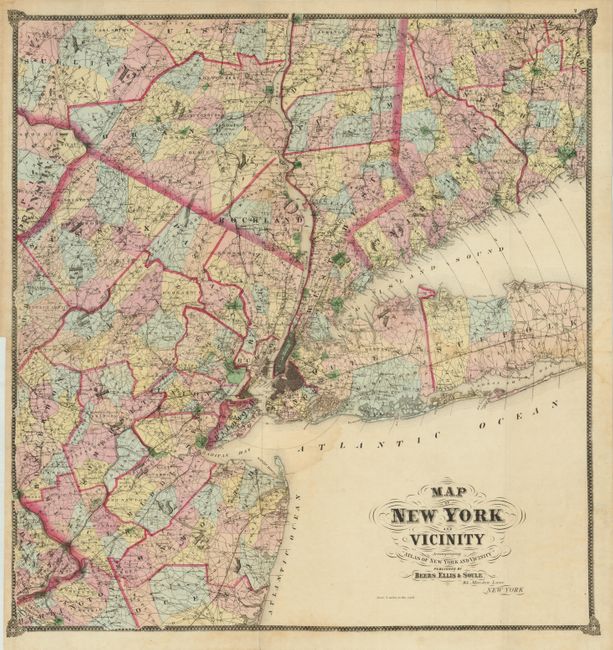
“Map of New York and Vicinity Accompanying "Atlas of New York and Vicinity"”
Map Maker:
Beers, Ellis & Soule
This scarce map was published in this atlas, which... (full text available to subscribers)
| Item Detail |
| |
| |
MapMaker: |
Beers, Ellis & Soule
|
|
| |
| |
Subject: |
New York |
|
| |
Period/Size: |
1867 / 30.0" x 28.5" (76.2 x 72.4 cm)
|
|
| |
Color: |
Colored
|
|
| |
Condition: |
The map image is near fine with strong original color and a beautiful impression and displays very well despite the following flaws. Small (1/2") hole in Shohola County, 5" tear from binding trim is closed on verso and virtually invisible and a light wate (condition help) |
|
| |
Source: |
Atlas of New York and Vicinity from actual Surveys |
|
| |
References: |
|
|
| |
|
|
| Sales Information |
| |
| |
Price: |
|
|
| |
| |
Offered by: |
Old World Auctions |
|
| |
Catalog: |
Auction No. 136 - Antique Maps, Charts, Atlases & Globes (7407) |
|
| |
Lot/Item #: |
319 |
|
| |
| |
Date: |
06/2011
|
|
| |
| |
|
Antique Maps - Valuation and Pricing, Descriptions, Resources |
|
Home |
Information |
Search |
Register |
Contact Us |
Site Map
Americana Exchange, Inc. © 1999 - 2024 Americana Exchange, Inc.. All rights reserved.
OldMaps.com, the OldMaps.com logo and
AMPR are service marks or registered service marks of Americana Exchange, Inc..
|