Rister or Sign In to see pricing information


Title:

L'Isle St. Domingue ou Espagnole Decouverte l'An 1492. Par les Espagnols…

Map Maker:

Nicolas de Fer

L'Isle St. Domingue ou Espagnole Decouverte l'An 1492. Par les Espagnols…

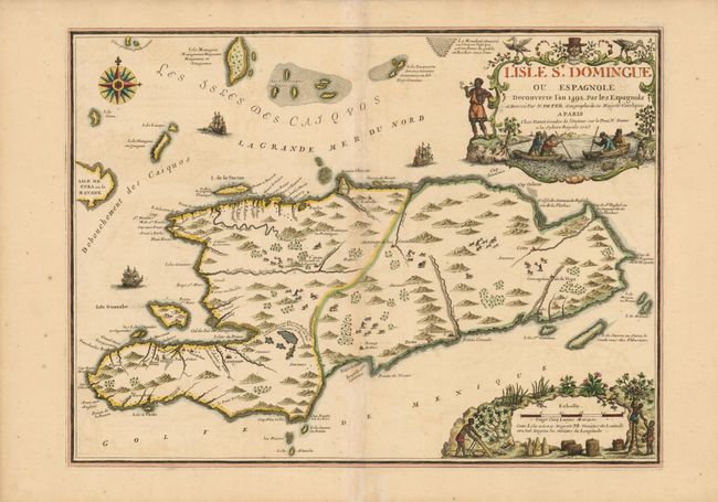
Map of Hispaniola and the Turks & Caicos Islands. ... (full text available to subscribers)
Item Detail
 
  MapMaker:  

Nicolas de Fer


  Subject:  Hispaniola  
  Period/Size:  1723 / 17.2" x 23.2"  (43.7 x 59.0 cm)  
  Color:  Colored  
  Condition:  Minor toning along the centerfold, which has been repaired with tissue on verso. Slight crease to the right of the centerfold. (condition help)  
  Source:   
  References:   
 
 
Sales Information
 
  Price: 

Please register your email to view records, or sign in with email address to see records


  Offered by:  Old World Auctions  
  Catalog:  Auction No. 136 - Antique Maps, Charts, Atlases & Globes (7407)  
  Lot/Item #:  404  
 
  Date:  06/2011  


Antique Maps - Valuation and Pricing, Descriptions, Resources


Home | Information | Search | Register | Contact Us | Site Map

Americana Exchange, Inc. © 1999 - 2024 Americana Exchange, Inc.. All rights reserved. OldMaps.com, the OldMaps.com logo and
AMPR are service marks or registered service marks of Americana Exchange, Inc..