Title:
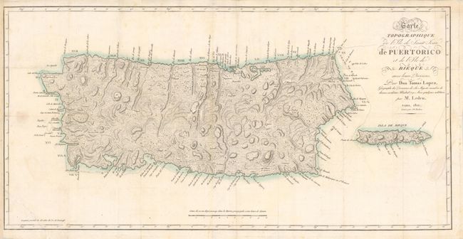
“Carte Topographique de l'Ile de Saint Jean de Puertorico et de l'Ile de Bieque…”
Map Maker:
Thomas Lopez y Vargas Machuca
This is the French reissue of Lopez' 1791 map of P... (full text available to subscribers)
| Item Detail |
| |
| |
MapMaker: |
Thomas Lopez y Vargas Machuca
|
|
| |
| |
Subject: |
Puerto Rico |
|
| |
Period/Size: |
1810 / 14.0" x 28.0" (35.6 x 71.2 cm)
|
|
| |
Color: |
Colored
|
|
| |
Condition: |
Tear in the bottom left corner of image has been professionally repaired. A few damp stains and minor spotting in the image. Issued folded and now flattened. (condition help) |
|
| |
Source: |
|
|
| |
References: |
|
|
| |
|
|
| Sales Information |
| |
| |
Price: |
|
|
| |
| |
Offered by: |
Old World Auctions |
|
| |
Catalog: |
Auction No. 136 - Antique Maps, Charts, Atlases & Globes (7407) |
|
| |
Lot/Item #: |
408 |
|
| |
| |
Date: |
06/2011
|
|
| |
| |
|
Antique Maps - Valuation and Pricing, Descriptions, Resources |
|
Home |
Information |
Search |
Register |
Contact Us |
Site Map
Americana Exchange, Inc. © 1999 - 2024 Americana Exchange, Inc.. All rights reserved.
OldMaps.com, the OldMaps.com logo and
AMPR are service marks or registered service marks of Americana Exchange, Inc..
|