Title:
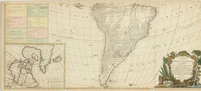
“A new map of the whole Continent of America, Divided into North and South and West Indies wherein are exactly described The United States of North America as well as the Several European Possessions…”
Map Maker:
Laurie & Whittle
These are the southern two sheets (joined) of a fo... (full text available to subscribers)
| Item Detail |
| |
| |
MapMaker: |
Laurie & Whittle
|
|
| |
| |
Subject: |
South America |
|
| |
Period/Size: |
1794 / 20.5" x 46.5" (52.1 x 118.2 cm)
|
|
| |
Color: |
Colored
|
|
| |
Condition: |
There are some tears along the bottom border entering the image and some chips out of the blank margin. Faint toning. (condition help) |
|
| |
Source: |
|
|
| |
References: |
Tooley (Amer) p. 51, #3f; Stevens & Tree #3f. |
|
| |
|
|
| Sales Information |
| |
| |
Price: |
|
|
| |
| |
Offered by: |
Old World Auctions |
|
| |
Catalog: |
Auction No. 136 - Antique Maps, Charts, Atlases & Globes (7407) |
|
| |
Lot/Item #: |
427 |
|
| |
| |
Date: |
06/2011
|
|
| |
| |
|
Antique Maps - Valuation and Pricing, Descriptions, Resources |
|
Home |
Information |
Search |
Register |
Contact Us |
Site Map
Americana Exchange, Inc. © 1999 - 2024 Americana Exchange, Inc.. All rights reserved.
OldMaps.com, the OldMaps.com logo and
AMPR are service marks or registered service marks of Americana Exchange, Inc..
|