Title:
“'T Huijs te Britten”
Map Maker:
Barent Langenes
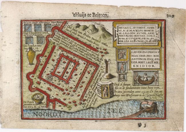
This tiny map shows a plan of the Roman ruin of Br... (full text available to subscribers)
| Item Detail |
| |
| |
MapMaker: |
Barent Langenes
|
|
| |
| |
Subject: |
Netherlands |
|
| |
Period/Size: |
1598 / 3.8" x 5.0" (9.7 x 12.7 cm)
|
|
| |
Color: |
Colored
|
|
| |
Condition: |
Dark impression with soiled margins. (condition help) |
|
| |
Source: |
Caert-Thresoor |
|
| |
References: |
King (2nd ed.) pp. 80-82. |
|
| |
|
|
| Sales Information |
| |
| |
Price: |
|
|
| |
| |
Offered by: |
Old World Auctions |
|
| |
Catalog: |
Auction No. 136 - Antique Maps, Charts, Atlases & Globes (7407) |
|
| |
Lot/Item #: |
513 |
|
| |
| |
Date: |
06/2011
|
|
| |
| |
|
Antique Maps - Valuation and Pricing, Descriptions, Resources |
|
Home |
Information |
Search |
Register |
Contact Us |
Site Map
Americana Exchange, Inc. © 1999 - 2024 Americana Exchange, Inc.. All rights reserved.
OldMaps.com, the OldMaps.com logo and
AMPR are service marks or registered service marks of Americana Exchange, Inc..
|