Title:
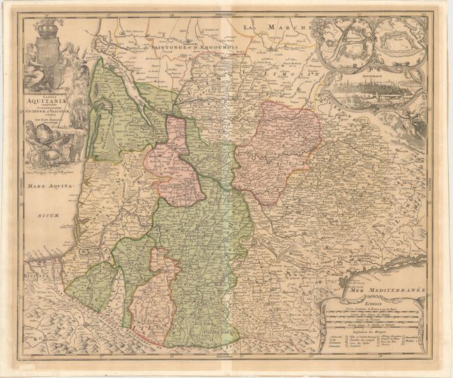
“Tabula Aquitaniae complectens Gubernationem Guiennae, et Vasconiae”
Map Maker:
Johann Baptist Homann
This is a large and decorative map of southeastern... (full text available to subscribers)
| Item Detail |
| |
| |
MapMaker: |
Johann Baptist Homann
|
|
| |
| |
Subject: |
France |
|
| |
Period/Size: |
1720 / 19.0" x 22.5" (48.3 x 57.2 cm)
|
|
| |
Color: |
Colored
|
|
| |
Condition: |
Very dark impression and original color. On sound paper that was previously framed leaving behind mounting paper on verso at edges. The map image has overall toning from framing. The centerfold backstrap protected this region from toning resulting in a (condition help) |
|
| |
Source: |
|
|
| |
References: |
|
|
| |
|
|
| Sales Information |
| |
| |
Price: |
|
|
| |
| |
Offered by: |
Old World Auctions |
|
| |
Catalog: |
Auction No. 136 - Antique Maps, Charts, Atlases & Globes (7407) |
|
| |
Lot/Item #: |
532 |
|
| |
| |
Date: |
06/2011
|
|
| |
| |
|
Antique Maps - Valuation and Pricing, Descriptions, Resources |
|
Home |
Information |
Search |
Register |
Contact Us |
Site Map
Americana Exchange, Inc. © 1999 - 2024 Americana Exchange, Inc.. All rights reserved.
OldMaps.com, the OldMaps.com logo and
AMPR are service marks or registered service marks of Americana Exchange, Inc..
|