Rister or Sign In to see pricing information


Title:

Carte Generale de l'Empire Chinois et du Japan

Map Maker:

Adrien Hubert Brue

Carte Generale de l'Empire Chinois et du Japan

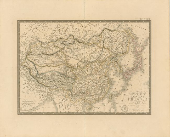
Beautifully engraved and highly detailed map that ... (full text available to subscribers)
Item Detail
 
  MapMaker:  

Adrien Hubert Brue


  Subject:  China, Korea and Japan  
  Period/Size:  1836 / 14.3" x 20.3"  (36.4 x 51.6 cm)  
  Color:  Colored  
  Condition:  Crisp impression and fine outline color on a full sheet with wide, untrimmed margins. Faint offsetting from one color, still very good. (condition help)  
  Source:  Atlas Universel  
  References:   
 
 
Sales Information
 
  Price: 

Please register your email to view records, or sign in with email address to see records


  Offered by:  Old World Auctions  
  Catalog:  Auction No. 136 - Antique Maps, Charts, Atlases & Globes (7407)  
  Lot/Item #:  691  
 
  Date:  06/2011  


Antique Maps - Valuation and Pricing, Descriptions, Resources


Home | Information | Search | Register | Contact Us | Site Map

Americana Exchange, Inc. © 1999 - 2024 Americana Exchange, Inc.. All rights reserved. OldMaps.com, the OldMaps.com logo and
AMPR are service marks or registered service marks of Americana Exchange, Inc..