Title:
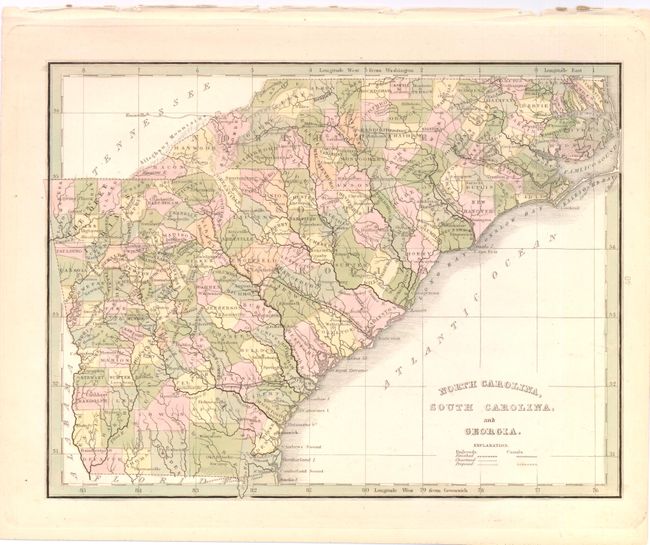
“North Carolina, South Carolina, and Georgia”
Map Maker:
Thomas Gamaliel Bradford
A fine map of the Southeast showing counties, majo... (full text available to subscribers)
| Item Detail |
| |
| |
MapMaker: |
Thomas Gamaliel Bradford
|
|
| |
| |
Subject: |
Southeastern United States |
|
| |
Period/Size: |
1835 / 7.8" x 10.3" (19.9 x 26.2 cm)
|
|
| |
Color: |
Colored
|
|
| |
Condition: |
Original color with light toning in blank margins and binding holes in upper blank margin, well away from the map. (condition help) |
|
| |
Source: |
A Comprehensive Atlas |
|
| |
References: |
|
|
| |
|
|
| Sales Information |
| |
| |
Price: |
|
|
| |
| |
Offered by: |
Old World Auctions |
|
| |
Catalog: |
Auction No. 137 - Antique Maps, Charts, Atlases & Globes (7408) |
|
| |
Lot/Item #: |
225 |
|
| |
| |
Date: |
09/2011
|
|
| |
| |
|
Antique Maps - Valuation and Pricing, Descriptions, Resources |
|
Home |
Information |
Search |
Register |
Contact Us |
Site Map
Americana Exchange, Inc. © 1999 - 2024 Americana Exchange, Inc.. All rights reserved.
OldMaps.com, the OldMaps.com logo and
AMPR are service marks or registered service marks of Americana Exchange, Inc..
|