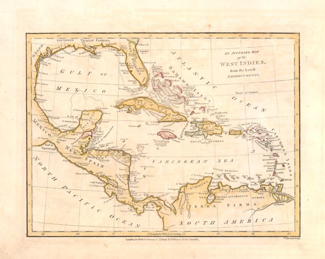
Title:
“An Accurate Map of the West Indies, from the Latest Improvements”
Map Maker:
Robert Wilkinson
This chart covers Florida and extends to show all ... (full text available to subscribers)
| Item Detail |
| |
| |
MapMaker: |
Robert Wilkinson
|
|
| |
| |
Subject: |
Gulf of Mexico and Caribbean |
|
| |
Period/Size: |
1806 / 7.0" x 10.0" (17.8 x 25.4 cm)
|
|
| |
Color: |
Colored
|
|
| |
Condition: |
There is a small chip in the lower left corner of the blank margins along with some light soiling. The image is good and has just s hint of toning. There are also a few faint pencil marks in the image that do not distract. (condition help) |
|
| |
Source: |
A General Atlas being a Collection of Maps of the Worldģ |
|
| |
References: |
|
|
| |
|
|
| Sales Information |
| |
| |
Price: |
|
|
| |
| |
Offered by: |
Old World Auctions |
|
| |
Catalog: |
Auction No. 137 - Antique Maps, Charts, Atlases & Globes (7408) |
|
| |
Lot/Item #: |
427 |
|
| |
| |
Date: |
09/2011
|
|
| |
| |
|
Antique Maps - Valuation and Pricing, Descriptions, Resources |
|
Home |
Information |
Search |
Register |
Contact Us |
Site Map
Americana Exchange, Inc. © 1999 - 2024 Americana Exchange, Inc.. All rights reserved.
OldMaps.com, the OldMaps.com logo and
AMPR are service marks or registered service marks of Americana Exchange, Inc..
|