| Item Detail |
| |
| |
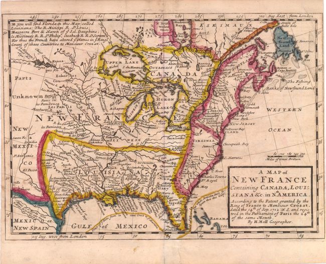
MapMaker: |
Herman Moll
|
|
| |
| |
Subject: |
Colonial United States and Canada |
|
| |
Period/Size: |
1708 / 7.3" x 10.3" (18.6 x 26.2 cm)
|
|
| |
Color: |
Colored
|
|
| |
Condition: |
Toned with a short separation at bottom centerfold, far from map image. Narrow side margins, nearly to neatline, as issued. (condition help) |
|
| |
Source: |
The British Empire in America |
|
| |
References: |
McCorkle #717-1. |
|
| |
|
|
| Sales Information |
| |
| |
Price: |
|
|
| |
| |
Offered by: |
Old World Auctions |
|
| |
Catalog: |
Auction No. 137 - Antique Maps, Charts, Atlases & Globes (7408) |
|
| |
Lot/Item #: |
139 |
|
| |
| |
Date: |
09/2011
|
|
| |
| |
|