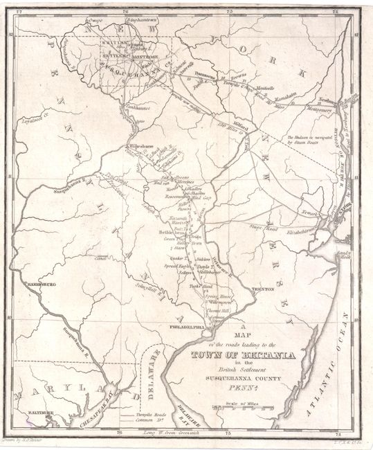
Title:
“A Map of the Roads Leading to the Town of Britania in the British Settlement Susquehanna County Penna”
Map Maker:
Henry Schenck Tanner
This very uncommon early American road map extends... (full text available to subscribers)
| Item Detail |
| |
| |
MapMaker: |
Henry Schenck Tanner
|
|
| |
| |
Subject: |
United States - New England |
|
| |
Period/Size: |
1819 / 8.0" x 6.5" (20.4 x 16.6 cm)
|
|
| |
Color: |
Black & White
|
|
| |
Condition: |
Issued folding. A small, unobtrusive spot in bottom-left corner and trimmed close to neatline at top. (condition help) |
|
| |
Source: |
|
|
| |
References: |
|
|
| |
|
|
| Sales Information |
| |
| |
Price: |
|
|
| |
| |
Offered by: |
Old World Auctions |
|
| |
Catalog: |
Auction No. 137 - Antique Maps, Charts, Atlases & Globes (7408) |
|
| |
Lot/Item #: |
200 |
|
| |
| |
Date: |
09/2011
|
|
| |
| |
|
Antique Maps - Valuation and Pricing, Descriptions, Resources |
|
Home |
Information |
Search |
Register |
Contact Us |
Site Map
Americana Exchange, Inc. © 1999 - 2024 Americana Exchange, Inc.. All rights reserved.
OldMaps.com, the OldMaps.com logo and
AMPR are service marks or registered service marks of Americana Exchange, Inc..
|