| Item Detail |
| |
| |
MapMaker: |
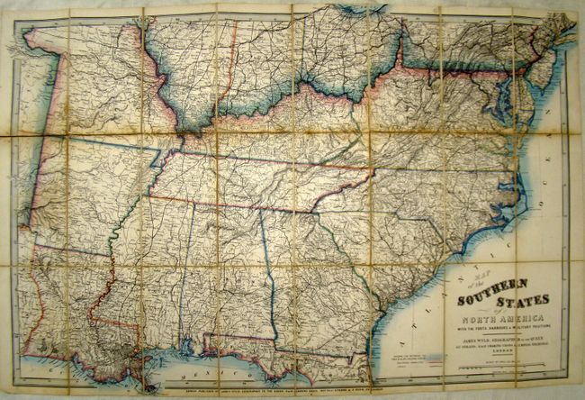
James Wyld
|
|
| |
| |
Subject: |
Southern United States |
|
| |
Period/Size: |
1861 / 26.5" x 39.0" (67.4 x 99.1 cm)
|
|
| |
Color: |
Colored
|
|
| |
Condition: |
The map is dissected into 24 sections and backed with linen. There is some minor paper loss along one of the folds and some isolated staining. Covers are nearly separated. (condition help) |
|
| |
Source: |
|
|
| |
References: |
|
|
| |
|
|
| Sales Information |
| |
| |
Price: |
|
|
| |
| |
Offered by: |
Old World Auctions |
|
| |
Catalog: |
Auction No. 137 - Antique Maps, Charts, Atlases & Globes (7408) |
|
| |
Lot/Item #: |
231 |
|
| |
| |
Date: |
09/2011
|
|
| |
| |
|