| Item Detail |
| |
| |
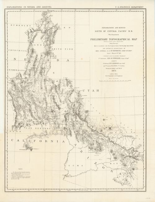
MapMaker: |
George M. Wheeler
|
|
| |
| |
Subject: |
Southwestern United States |
|
| |
Period/Size: |
1871 / 28.5" x 22.0" (72.4 x 55.9 cm)
|
|
| |
Color: |
Black & White
|
|
| |
Condition: |
There is one tiny spot in the image, but overall it is a clean and bright example. The sheet is backed with Japanese tissue to reinforce fold lines. The margin at left has been trimmed for binding, but is still adequate for framing. (condition help) |
|
| |
Source: |
|
|
| |
References: |
Wheat [TMW] #1237. |
|
| |
|
|
| Sales Information |
| |
| |
Price: |
|
|
| |
| |
Offered by: |
Old World Auctions |
|
| |
Catalog: |
Auction No. 137 - Antique Maps, Charts, Atlases & Globes (7408) |
|
| |
Lot/Item #: |
266 |
|
| |
| |
Date: |
09/2011
|
|
| |
| |
|