Title:
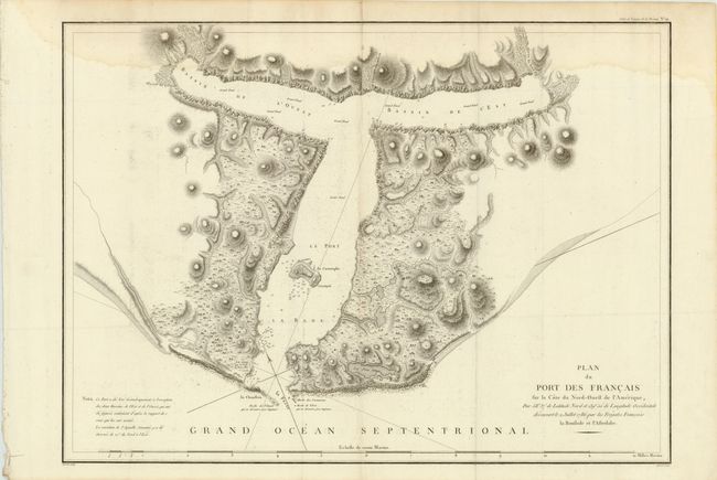
“Plan du Port des Francais sur la Cote du Nord-Ouest de l'Amerique, par 58°37' de Latitude Nord et 139°50' de Longitude Occidentale, Decouverte le 2 Juillet 1786, par les Fregates Francaise la Boussole et l'Astrolabe”
Map Maker:
Jean Francois Galaup de La Perouse
Fine, large chart of Lituya Bay, located within Gl... (full text available to subscribers)
| Item Detail |
| |
| |
MapMaker: |
Jean Francois Galaup de La Perouse
|
|
| |
| |
Subject: |
Alaska |
|
| |
Period/Size: |
1797 / 19.5" x 27.0" (49.6 x 68.6 cm)
|
|
| |
Color: |
Black & White
|
|
| |
Condition: |
Nice impression on thick hand laid paper with two large watermarks - one is a stone tower. Folding, as issued. Damp stain at top and a vertical crease down the center, with a small hole in blank area of map image. Binding holes in left blank margin, an (condition help) |
|
| |
Source: |
Atlas du Voyage de la Perouse |
|
| |
References: |
Falk #1797-11; Wagner #842. |
|
| |
|
|
| Sales Information |
| |
| |
Price: |
|
|
| |
| |
Offered by: |
Old World Auctions |
|
| |
Catalog: |
Auction No. 137 - Antique Maps, Charts, Atlases & Globes (7408) |
|
| |
Lot/Item #: |
270 |
|
| |
| |
Date: |
09/2011
|
|
| |
| |
|
Antique Maps - Valuation and Pricing, Descriptions, Resources |
|
Home |
Information |
Search |
Register |
Contact Us |
Site Map
Americana Exchange, Inc. © 1999 - 2024 Americana Exchange, Inc.. All rights reserved.
OldMaps.com, the OldMaps.com logo and
AMPR are service marks or registered service marks of Americana Exchange, Inc..
|