| Item Detail |
| |
| |
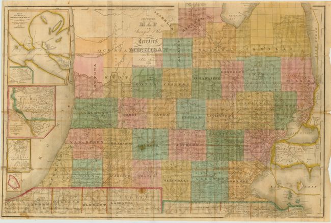
MapMaker: |
John Farmer
|
|
| |
| |
Subject: |
Michigan |
|
| |
Period/Size: |
1836 / 21.0" x 31.0" (53.4 x 78.8 cm)
|
|
| |
Color: |
Colored
|
|
| |
Condition: |
The map shows some light offsetting with a few small stains in the image. Small fold separations and splits have been repaired with archival material on verso. The map is issued folded and is separated from the covers. (condition help) |
|
| |
Source: |
|
|
| |
References: |
Karpinski #129. |
|
| |
|
|
| Sales Information |
| |
| |
Price: |
|
|
| |
| |
Offered by: |
Old World Auctions |
|
| |
Catalog: |
Auction No. 137 - Antique Maps, Charts, Atlases & Globes (7408) |
|
| |
Lot/Item #: |
337 |
|
| |
| |
Date: |
09/2011
|
|
| |
| |
|