Title:
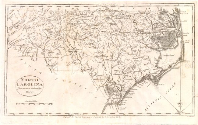
“North Carolina from the Best Authorities”
Map Maker:
John Willet Payne
This is an early map of the state of North Carolin... (full text available to subscribers)
| Item Detail |
| |
| |
MapMaker: |
John Willet Payne
|
|
| |
| |
Subject: |
North Carolina |
|
| |
Period/Size: |
1800 / 7.5" x 12.5" (19.1 x 31.8 cm)
|
|
| |
Color: |
Black & White
|
|
| |
Condition: |
Nice dark impression with minor creasing and a few small spots. A few tiny repairs made on verso. Issued folded. (condition help) |
|
| |
Source: |
New and Complete Universal Geography |
|
| |
References: |
|
|
| |
|
|
| Sales Information |
| |
| |
Price: |
|
|
| |
| |
Offered by: |
Old World Auctions |
|
| |
Catalog: |
Auction No. 137 - Antique Maps, Charts, Atlases & Globes (7408) |
|
| |
Lot/Item #: |
356 |
|
| |
| |
Date: |
09/2011
|
|
| |
| |
|
Antique Maps - Valuation and Pricing, Descriptions, Resources |
|
Home |
Information |
Search |
Register |
Contact Us |
Site Map
Americana Exchange, Inc. © 1999 - 2024 Americana Exchange, Inc.. All rights reserved.
OldMaps.com, the OldMaps.com logo and
AMPR are service marks or registered service marks of Americana Exchange, Inc..
|