Title:
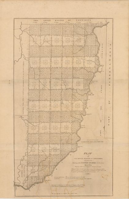
“Plat of the Seven Ranges of Townships Being Part of the Territory of the United States N. W. of the River Ohio…”
Map Maker:
Thomas Hutchins
An important early map of Ohio completed under the... (full text available to subscribers)
| Item Detail |
| |
| |
MapMaker: |
Thomas Hutchins
|
|
| |
| |
Subject: |
Ohio |
|
| |
Period/Size: |
1814 / 13.0" x 23.5" (33.1 x 59.7 cm)
|
|
| |
Color: |
Black & White
|
|
| |
Condition: |
Strong impression with some light scattered foxing and staining, along with some faint offsetting. (condition help) |
|
| |
Source: |
Mathew Carey's General Atlas |
|
| |
References: |
Phillips (A) 722-28; cf Wheat & Brun 677. |
|
| |
|
|
| Sales Information |
| |
| |
Price: |
|
|
| |
| |
Offered by: |
Old World Auctions |
|
| |
Catalog: |
Auction No. 137 - Antique Maps, Charts, Atlases & Globes (7408) |
|
| |
Lot/Item #: |
358 |
|
| |
| |
Date: |
09/2011
|
|
| |
| |
|
Antique Maps - Valuation and Pricing, Descriptions, Resources |
|
Home |
Information |
Search |
Register |
Contact Us |
Site Map
Americana Exchange, Inc. © 1999 - 2024 Americana Exchange, Inc.. All rights reserved.
OldMaps.com, the OldMaps.com logo and
AMPR are service marks or registered service marks of Americana Exchange, Inc..
|