| Item Detail |
| |
| |
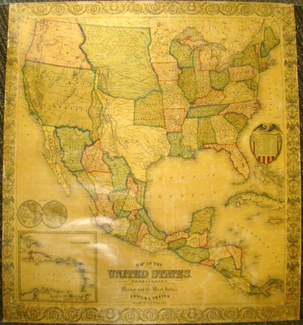
MapMaker: |
Ensign, Thayer [& Co.]
|
|
| |
| |
Subject: |
United States, Mexico, Caribbean |
|
| |
Period/Size: |
1850 / 35.0" x 32.0" (88.9 x 81.3 cm)
|
|
| |
Color: |
Colored
|
|
| |
Condition: |
Very nice example. There is some minor image loss along the borders and a tiny hole off the coast of Oregon. Some minor staining at lower left. Map is varnished and backed with linen, as issued. Rollers are missing. (condition help) |
|
| |
Source: |
|
|
| |
References: |
|
|
| |
|
|
| Sales Information |
| |
| |
Price: |
|
|
| |
| |
Offered by: |
Old World Auctions |
|
| |
Catalog: |
Auction No. 137 - Antique Maps, Charts, Atlases & Globes (7408) |
|
| |
Lot/Item #: |
408 |
|
| |
| |
Date: |
09/2011
|
|
| |
| |
|