| Item Detail |
| |
| |
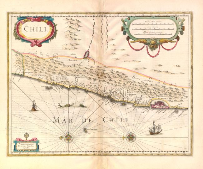
MapMaker: |
Henricus Hondius
|
|
| |
| |
Subject: |
Chile |
|
| |
Period/Size: |
1640 / 14.8" x 19.0" (37.6 x 48.3 cm)
|
|
| |
Color: |
Colored
|
|
| |
Condition: |
Nice impression in original color with some minor staining along the centerfold and light text show-through. The top blank margin has hinge tape and there is a tiny separation at bottom centerfold that does not impact the image. (condition help) |
|
| |
Source: |
|
|
| |
References: |
|
|
| |
|
|
| Sales Information |
| |
| |
Price: |
|
|
| |
| |
Offered by: |
Old World Auctions |
|
| |
Catalog: |
Auction No. 137 - Antique Maps, Charts, Atlases & Globes (7408) |
|
| |
Lot/Item #: |
469 |
|
| |
| |
Date: |
09/2011
|
|
| |
| |
|