Title:
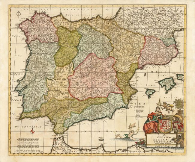
“Accuratissima Totius Regni Hispaniae Portugalliae Tabula et Typus Novissimus…”
Map Maker:
Frederick de Wit
This map of Portugal, Spain and the Balearic Islan... (full text available to subscribers)
| Item Detail |
| |
| |
MapMaker: |
Frederick de Wit
|
|
| |
| |
Subject: |
Spain & Portugal |
|
| |
Period/Size: |
1690 / 19.5" x 23.3" (49.6 x 59.2 cm)
|
|
| |
Color: |
Colored
|
|
| |
Condition: |
Original outline color with minor soiling and a centerfold separation that enters map image 1/4" and had been closed on verso with archival tape. (condition help) |
|
| |
Source: |
|
|
| |
References: |
|
|
| |
|
|
| Sales Information |
| |
| |
Price: |
|
|
| |
| |
Offered by: |
Old World Auctions |
|
| |
Catalog: |
Auction No. 137 - Antique Maps, Charts, Atlases & Globes (7408) |
|
| |
Lot/Item #: |
571 |
|
| |
| |
Date: |
09/2011
|
|
| |
| |
|
Antique Maps - Valuation and Pricing, Descriptions, Resources |
|
Home |
Information |
Search |
Register |
Contact Us |
Site Map
Americana Exchange, Inc. © 1999 - 2024 Americana Exchange, Inc.. All rights reserved.
OldMaps.com, the OldMaps.com logo and
AMPR are service marks or registered service marks of Americana Exchange, Inc..
|